Our drones are invaluable tools for municipal inspections, offering efficiency, safety, and cost savings.
Grizzly Drone Services are available to support municipalities with:
Infrastructure Inspections: Drones can inspect bridges, roads, and buildings for structural integrity, capturing high-resolution images and videos without the need for scaffolding or heavy equipment.
Utility Monitoring: They can survey power lines, water towers, and pipelines, identifying issues like leaks or damage quickly and accurately.
Urban Planning: Drones provide aerial mapping and 3D modeling, aiding in city planning and development projects.
Environmental Monitoring: They help monitor green spaces, waterways, and wildlife, ensuring compliance with environmental regulations.
Bylaw Enforcement: They can monitor compliance with building codes, land-use regulations, and environmental bylaws, identifying violations quickly and accurately, in accordance with the Municipal Government Act.
Traffic Management: Drones can assess traffic patterns and congestion, helping municipalities plan better road networks and improve traffic flow.
Municipal Inspections

CPTED-Based Security Assessments: We conduct thorough security assessments of your home or commercial property using Crime Prevention Through Environmental Design (CPTED) principles.
Vacant Property Security Recommendations: We assess both short-term and long-term security needs for vacant properties and provide tailored recommendations to ensure they remain secure.
Making Properties Appear Occupied: We offer strategies to make your property look non-vacant, including lighting, landscaping, and security features, to deter potential intruders.
Natural Surveillance: We evaluate visibility around your property and recommend adjustments to improve observation from the street, reducing hidden areas for criminal activity.
Access Control: We identify vulnerable entry points and recommend measures to strengthen access control and prevent unauthorized entry.
Territorial Reinforcement: We suggest ways to establish clear boundaries and reinforce the perception that your property is actively monitored and cared for.
Ongoing Monitoring Advice: Based on our assessment, we provide guidance on how to maintain ongoing security checks and monitoring for long-term peace of mind.
Security Consultation
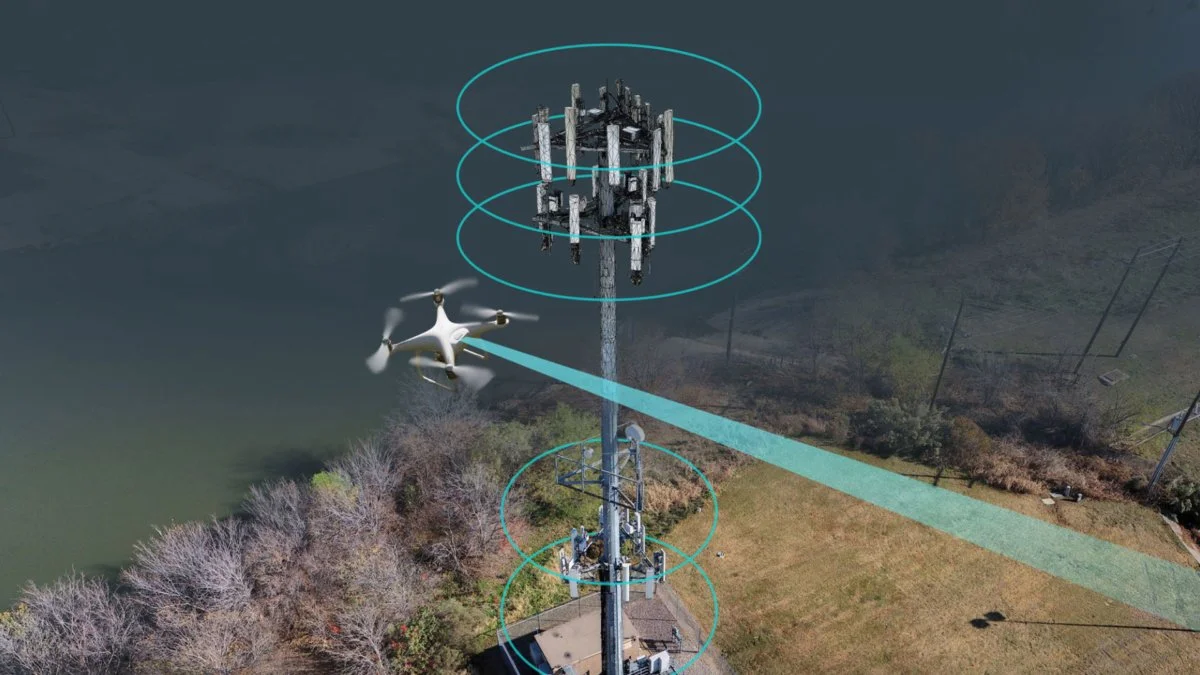
Tower Inspections
Keep your assets safe, compliant, and fully documented without the risks of climbing or costly equipment rentals. Our aerial inspection services provide detailed imagery and inventory records of towers with speed, precision, and safety.
High-Resolution Visual Inspections: Capture high resolution photos and 4K Ultra-HD video to spot rust, wear, or misaligned components with crystal clarity.
Complete Inventory Documentation: Create a visual log of mounted antennas, dishes, cabling, and safety equipment for maintenance records and audits.
360° Coverage from Base to Apex: Using precision flight paths and gimbal rotation, we record every angle and elevation of your structure.
Progress Tracking & Compliance: Before-and-after comparisons to document new installations, upgrades, or repair work.
Safe & Efficient Operations: Omnidirectional obstacle sensing and non-GNSS return capabilities ensure safe flights, even near complex tower structures.
Applications: Cell phone towers; Radio & broadcast towers; Internet & microwave relays; and Utility and electrical structures
Deliverables: Annotated photo reports; Video inspection footage; Asset inventory logs; and Before/after project documentation

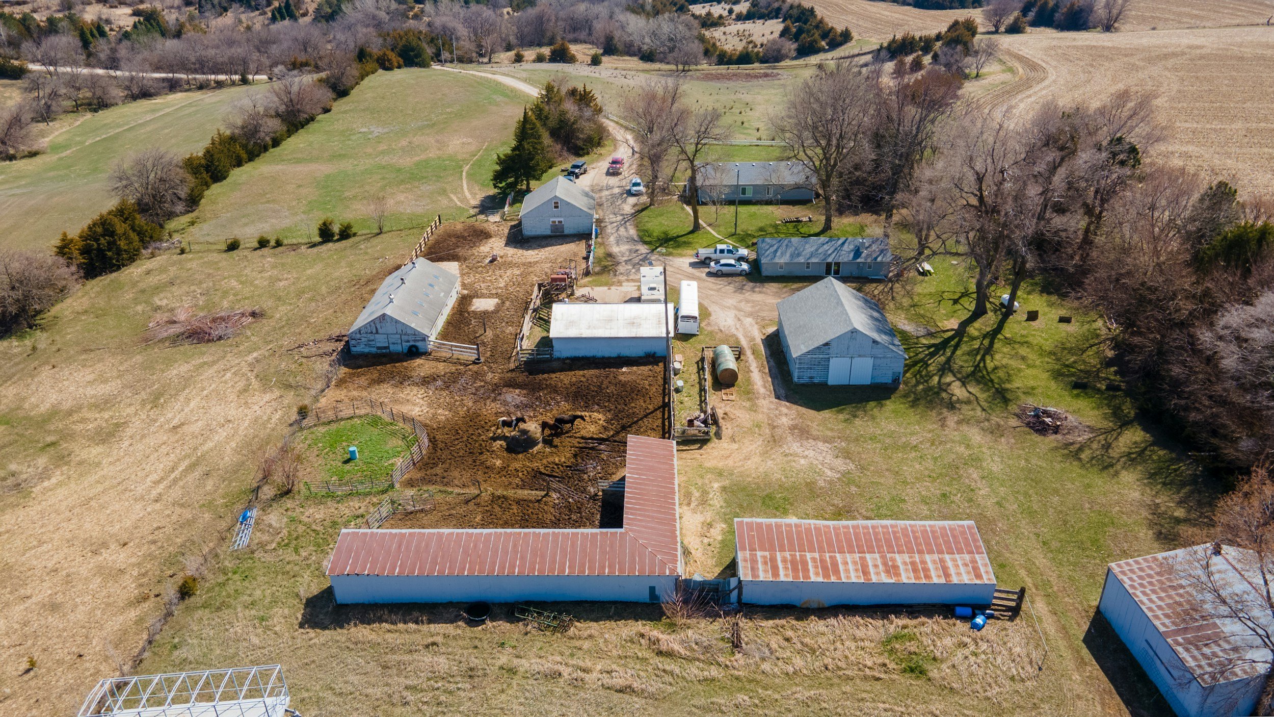
Real Estate
Grizzly Drone Services employ high resolution aerial photography and videography to provide:
Stunning Visuals: Drones capture breathtaking aerial views, providing property owners, potential buyers, or real estate agents, with a unique perspective of homes, acreages, farms, including surrounding landscapes and neighborhoods.
Enhanced Marketing: High-quality drone footage, including videos and 360-degree panoramas, creates immersive virtual tours that make listings stand out.
Cost and Time Efficiency: Drones reduce the need for multiple site visits by capturing comprehensive visuals in one go, saving time and money for agents and clients.
Detailed Surveys: They assist in site surveys and mapping, especially for large or commercial properties, offering accurate data for planning and development.
Showcasing Unique Features: Drones highlight property features like pools, gardens, or expansive land that might be difficult to capture from the ground.
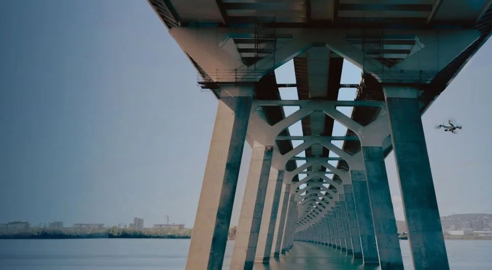
Bridge Inspections
Our high-quality drone gives you safer, faster, and more accurate bridge inspections—without lane closures, scaffolding, or putting workers in harm’s way.
Using ultra-clear imaging and precision flight control, we capture every angle of the structure: decks, girders, piers, bearings, and hard-to-reach undersides.
Advanced sensors reveal cracks, corrosion, spalling, heat anomalies, and early signs of structural stress long before they become expensive problems.
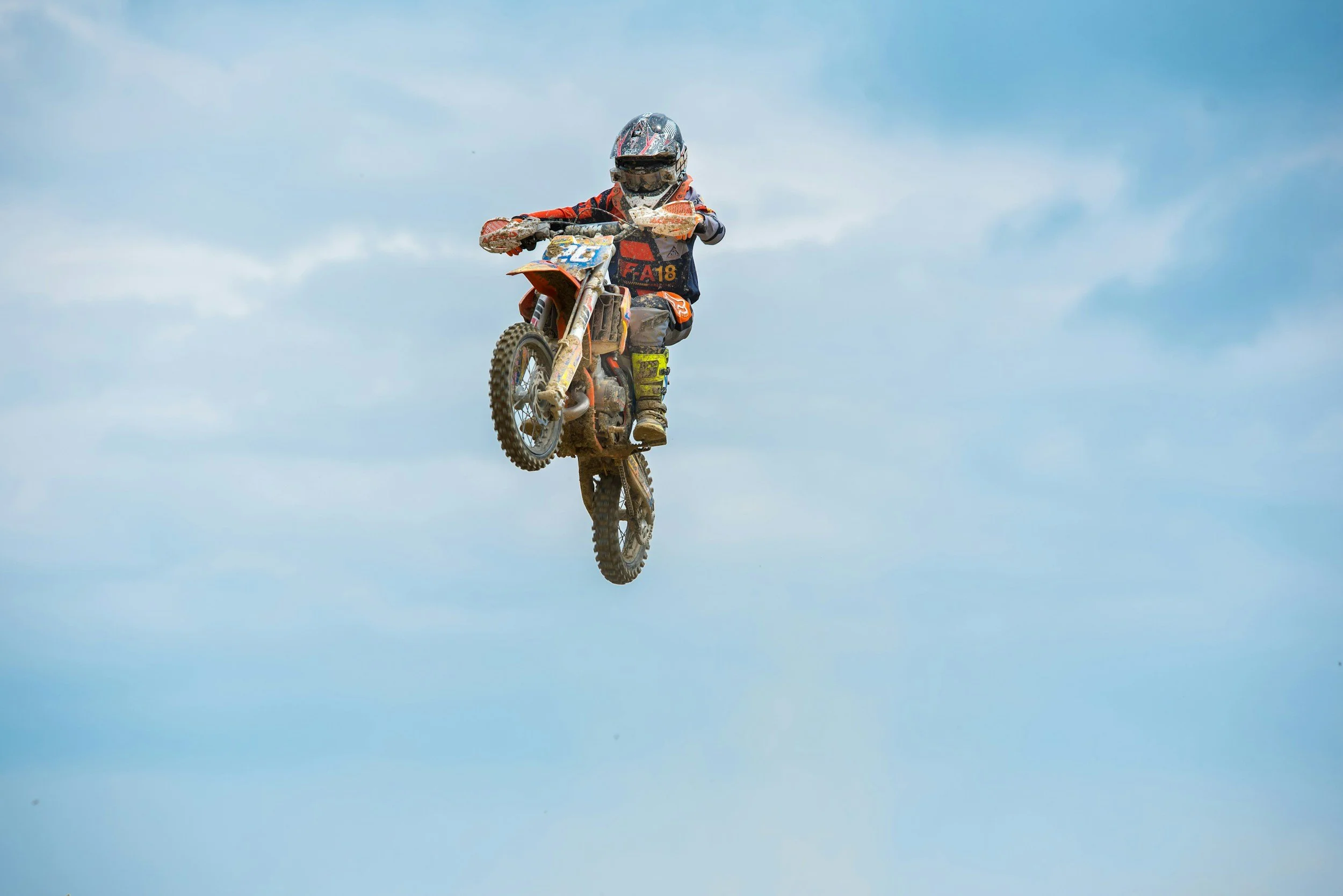
Aerial Special Event Coverage
Our high-performance aerial imaging platforms are designed to capture dynamic, professional-quality footage across a wide range of events and activities. From competitive sporting events and individual races to recreational adventures and social gatherings, it delivers cinematic perspectives that elevate visual storytelling and audience engagements.
For team sports and organized competitions, the drone provides sweeping aerial overviews, sideline tracking shots, and strategic top-down perspectives that highlight movement, formations, and game flow. Its stabilized 4K video and intelligent tracking capabilities allow smooth coverage of fast-paced action, making it ideal for highlight reels, promotional content, coaching analysis, and event recaps. Pre-planned flight paths and waypoint features ensure consistent, repeatable angles for professional production value.In running, cycling, motorsports, and endurance events, the drone excels at capturing start-line energy, mid-course intensity, and finish-line celebrations. Advanced subject tracking and follow modes enable seamless motion capture, keeping athletes centered in frame while maintaining cinematic smoothness. Course-mapping capabilities also allow for comprehensive aerial overviews that showcase terrain, route design, and event scale.For outdoor recreation such as hiking, biking, water sports, snow sports, and beach activities, the drone enhances storytelling with immersive, scenic perspectives. Establishing shots provide environmental context, while orbit and tracking modes create engaging, action-driven sequences. High-resolution capture and slow-motion capabilities add dramatic impact, making the footage ideal for personal branding, social media content, and promotional campaigns.Weddings, festivals, corporate events, and community celebrations benefit from elevated group shots and wide-angle perspectives that capture atmosphere and scale. Aerial establishing footage adds a polished, cinematic dimension to event videos, complementing traditional ground-based coverage. Discreet operation and stable flight performance allow for visually striking content while maintaining a professional presence.Professional Standards and Safety - All operations prioritize safety, regulatory compliance, and responsible flight practices. Flights are conducted within legal airspace guidelines, maintaining visual line of sight and appropriate distance from crowds and restricted areas. Careful pre-flight planning ensures smooth execution, optimal lighting conditions, and efficient battery management for uninterrupted coverage.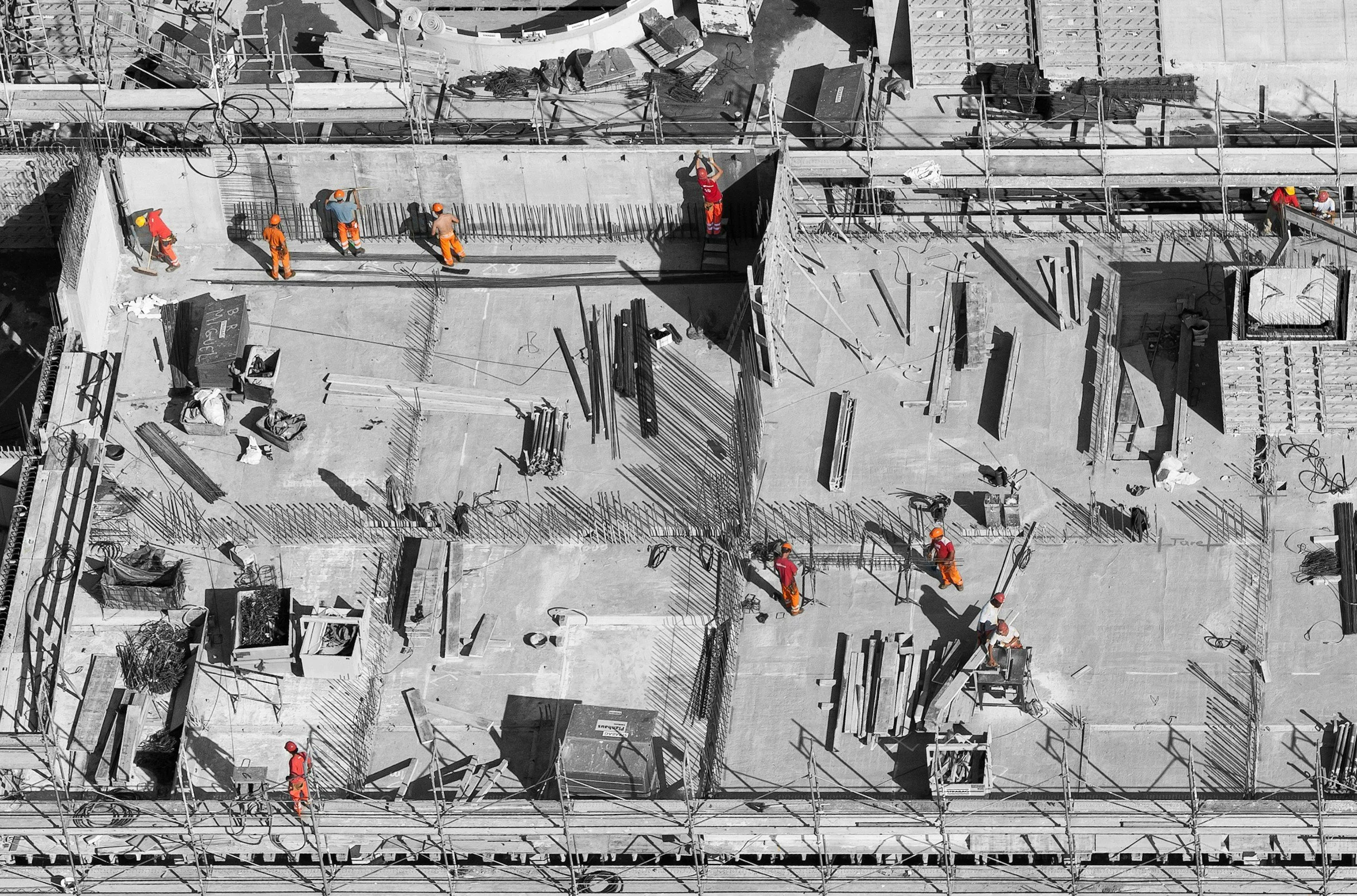
Construction & Development
Our drones provide construction and development teams with fast, accurate, and cost-effective insight across every project phase.
From aerial surveying and site progress tracking to volumetric measurements and inspections, advanced drone technology delivers high-resolution data that improves decision-making, reduces risk, and enhances collaboration.
By capturing consistent, real-time visuals and analytics, drones help teams stay on schedule, control costs, and maintain a clear, comprehensive view of the project lifecycle.